Google Earth Engine——南极洲高程模型(REMA)2米和8米的空间分辨率数据集

Google Earth Engine——南极洲高程模型(REMA)2米和8米的空间分辨率数据集

此星光明
发布于 2024-02-02 12:22:33
发布于 2024-02-02 12:22:33
镶嵌后REMA数据
The Reference Elevation Model of Antarctica (REMA) is a high resolution, time-stamped Digital Surface Model (DSM) of Antarctica at 2-meter and 8-meter spatial resolutions.
Mosaicked DEM files are compiled from multiple strips that have been co-registered, blended, and feathered to reduce edge-matching artifacts.
南极洲参考高程模型(REMA)是一个高分辨率、有时间戳的南极洲数字表面模型(DSM),具有2米和8米的空间分辨率。
镶嵌的DEM文件是由多个条带汇编而成的,这些条带经过共同登记、混合和羽化,以减少边缘匹配的人工痕迹。
Dataset Availability
2009-01-01T00:00:00 - 2018-01-01T00:00:00
Dataset Provider
University of Minnesota Polar Geospatial Center
Collection Snippet
ee.Image("UMN/PGC/REMA/V1_1/8m")
Resolution
8 meters
Bands Table
Name | Description | Units |
|---|---|---|
elevation | Elevation | meters |
数据说明:
美国国家科学基金会(PGC的主要资金来源)的政策要求研究人员在所有出版物、网页和媒体采访中承认NSF的支持。
通过在地球引擎中使用PGC数据,用户同意引用PGC及其由NSF提供的赞助。由PGC提供的任何第三方数据的原始来源也必须适当注明。
数据引用:
Howat, I. M., Porter, C., Smith, B. E., Noh, M.-J., and Morin, P.: The Reference Elevation Model of Antarctica, The Cryosphere, 13, 665-674, 2019.
TC - The Reference Elevation Model of Antarctica
代码:
var mosaic = ee.Image('UMN/PGC/REMA/V1_1/8m');

Map.setCenter(85, -75, 3);

var elevationVis = {
  bands: ['elevation'],
  min: -50.0,
  max: 1000.0,
  palette: ['0d13d8', '60e1ff', 'ffffff'],
};

Map.addLayer(mosaic, elevationVis, 'REMA_DEM_mosaic_8m');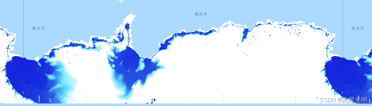
2m分辨率数据:
Strip DEM files correspond to the overlapping area of the input stereoscopic imagery pair strips as they are collected by DigitalGlobe’s constellation of polar-orbiting satellites. Strip DEM dimensions will vary according to the satellite sensor that acquired the images and the off-nadir angle of collection. Most strips are between 13 km and 17 km in width, and 110 km and 120 km in length.
条状DEM文件与输入的立体图像对条的重叠区域相对应,因为它们是由数字地球公司的极地轨道卫星群收集的。条状DEM的尺寸将根据获取图像的卫星传感器和收集的离地角度而变化。大多数条带的宽度在13公里到17公里之间,长度在110公里到120公里之间。
Collection Snippet
ee.ImageCollection("UMN/PGC/REMA/V1/2m")
Resolution
2 meters
波段信息:
Name | Description | Units |
|---|---|---|
elevation | Elevation | meters |
matchtag | Bitmask raster indicating DEM pixels processing | |
matchtag Bitmask | Bit 0: Pixel processing 0: Pixels have been interpolated1: Pixels are derived from a stereo match | |
- Bit 0: Pixel processing
- 0: Pixels have been interpolated
- 1: Pixels are derived from a stereo match
代码:
var collection = ee.ImageCollection('UMN/PGC/REMA/V1/2m');

Map.setCenter(85, -75, 3);

var elevationVis = {
  bands: ['elevation'],
  min: -50.0,
  max: 1000.0,
  palette: ['0d13d8', '60e1ff', 'ffffff'],
};

Map.addLayer(collection, elevationVis, 'REMA_DEM_strips_2m');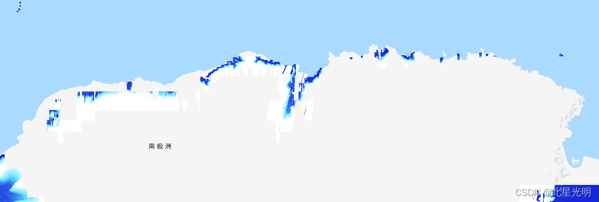
8m分辨率数据:
Collection Snippet
ee.ImageCollection("UMN/PGC/REMA/V1/8m")
Resolution
8 meters
波段信息
Name | Description | Units |
|---|---|---|
elevation | Elevation | meters |
matchtag | Bitmask raster indicating DEM pixels processing | |
matchtag Bitmask | Bit 0: Pixel processing 0: Pixels have been interpolated1: Pixels are derived from a stereo match | |
- Bit 0: Pixel processing
- 0: Pixels have been interpolated
- 1: Pixels are derived from a stereo match
代码:
var collection = ee.ImageCollection('UMN/PGC/REMA/V1/8m');

Map.setCenter(85, -75, 3);

var elevationVis = {
  bands: ['elevation'],
  min: -50.0,
  max: 1000.0,
  palette: ['0d13d8', '60e1ff', 'ffffff'],
};

Map.addLayer(collection, elevationVis, 'REMA_DEM_strips_8m');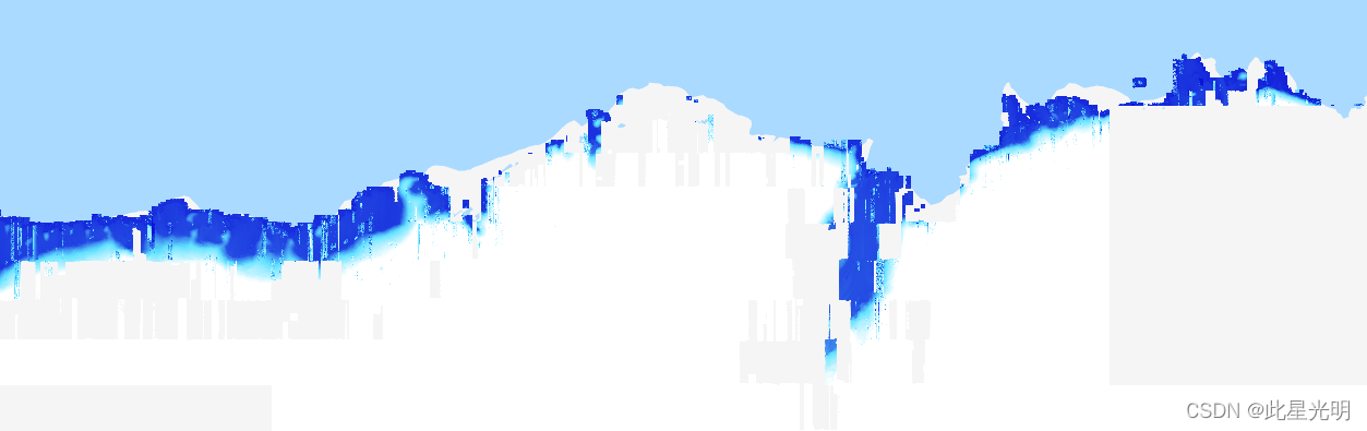
本文参与 腾讯云自媒体同步曝光计划,分享自作者个人站点/博客。
原始发表:2024-02-01,如有侵权请联系 cloudcommunity@tencent.com 删除
评论
登录后参与评论
推荐阅读
目录
腾讯云开发者

Copyright © 2013 - 2026 Tencent Cloud. All Rights Reserved. 腾讯云 版权所有
深圳市腾讯计算机系统有限公司 ICP备案/许可证号:粤B2-20090059 ![]() 粤公网安备44030502008569号
粤公网安备44030502008569号
腾讯云计算(北京)有限责任公司 京ICP证150476号 | 京ICP备11018762号